Madagascar's Grand South: from the Itasy volcanoes to Cape Sainte-Marie and Lokaro Bay
Twenty-two days from the center of the island to its far south: volcanoes, granite, sandstone and limestone, vezo lagoons, mahafaly plateau and antandroy country, until the beaches of Lokaro.
Duration
22 days
From
€2,200/pers.
Ideal seasons
Apr, May, Jun, Jul, Aug, Sep
Style
Guided tour
Comfort
Charm & Character
Travelers
Couple, Solo, With friends
The spirit of travel
This journey crosses Madagascar from the center to its far south, then climbs the coast up to Fort-Dauphin. It follows the great road of the Highlands, national route 7, then leaves it for the trails of the Southwest and the antandroy country, where roads become rare and the sea sometimes takes over.
We depart west of Antananarivo, towards the Itasy region, its lakes and volcanic cones. We then join national route 7 at Antsirabe, then Ambositra and its marquetry craftsmen, the humid forest of Ranomafana and Fianarantsoa, the capital of the betsileo country.
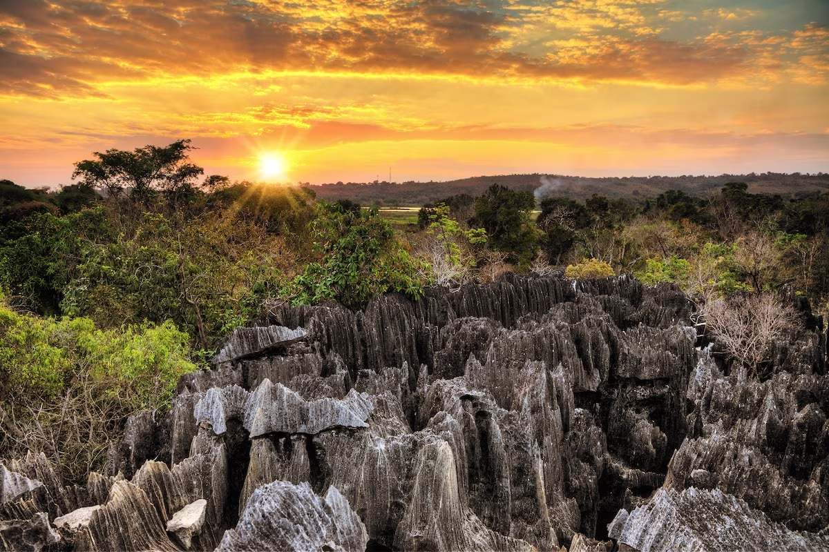
Further south, the journey takes time to walk. At Anja, the forest and ring-tailed lemurs live at the foot of rocky chaos. At Tsaranoro, we spend an entire day at the foot of an immense granite cliff, which has become one of the world's great climbing sites, with two routes to choose from. In Isalo, sandstone canyons open onto natural pools. This route brings together volcanic rocks, granite, sandstone and then the limestone of the mahafaly plateau: each massif tells an episode of the island's history, and it is their complementarity that makes the richness of the journey.
After Tuléar, the sea takes over. A boat, then a motorized pirogue, take us to a lagoon in the vezo country, where we spend two nights in simple bungalows with our hosts. The coastal trail then takes us to the salt lake of Tsimanampetsotsa, to Itampolo, then across the mahafaly plateau to the cliffs of Lavanono and Cape Saint-Marie.
The last part of the journey crosses the antandroy country to Fort-Dauphin. Within a few dozen kilometers, the spiny forest gives way to humid forest, at the foot of the anosyan range. A pirogue takes us through the channels to the village of Evatraha, and we reach on foot Lokaro Bay for two nights on the edge of the Indian Ocean.
We travel in a 4x4 with a driver-guide, who is also our mission leader. He knows the trails of the South and explains to us the landscapes, history and customs of the regions we cross. In the parks and reserves, local guides accompany us, and their knowledge of the terrain complements his.
Comfort varies throughout the journey. On RN7, we sleep in good quality hotels. On the coast of the Southwest and at Lavanono, accommodations are simple, sometimes with bucket showers, and places are limited: they are confirmed at booking, and equivalent accommodation is offered in the same village if they are full. The journey takes place from late April to November, during the dry season.
Détours Madagascar is committed to the Travelife certification process. On this journey, this translates concretely: we work with local guides in each park, we favor small accommodations run by local residents, and our visits make room for local initiatives. At Anja, the reserve is managed by the village association, and its revenues fund agriculture, health and schooling for local families. At Fianarantsoa, we meet Relais Madagascar, an insertion enterprise that creates jobs in the city.
The stages of your journey
Highlights
Day-by-day itinerary
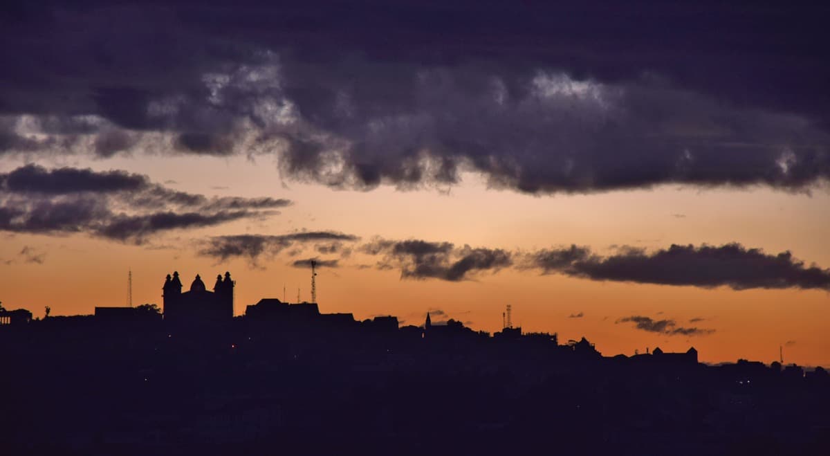
Arrival in Antananarivo
Upon our arrival at Ivato International Airport, a member of the Détours Madagascar team welcomes us and takes us to our hotel, in downtown Antananarivo.
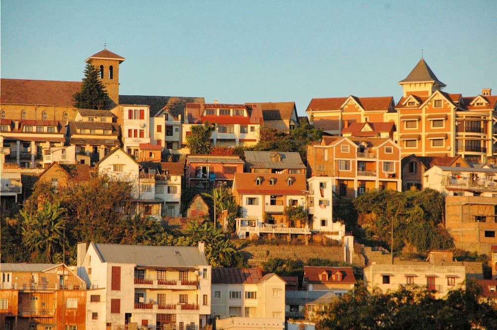
Depending on our flight time, we discover the first faces of the capital along the way. The city is built on about a dozen hills, in the middle of the rice fields of the Betsimitatatra plain. The brick houses with stories and wooden balconies are crowded on the slopes, and staircases connect the upper districts to the markets of the lower town.
Antananarivo was born in the 17th century on the highest of these hills, around the palace of the Merina sovereigns. It is today a lively capital, where life takes place largely in the street: street vendors, minibuses, rickshaws and carts share the road, in joyful disorder.
This first evening, we take time to settle in and rest from the journey. Our team answers our last questions about how the tour will unfold. We meet our driver-guide, who will also be our mission leader throughout our crossing of the South.
Tomorrow, we leave the capital by the west, towards the lakes and volcanoes of Itasy. Dinner is on your own, and it's an opportunity to taste the cuisine of the Highlands in one of the city's fine restaurants.
Driving

Towards Itasy, Land of Lakes and Volcanoes
We leave Antananarivo heading west on national road 1. The rice fields of the plain gradually give way to drier hills, then the landscape changes: perfectly shaped volcanic cones appear on the horizon. We are entering the Itasy region.
These volcanoes are young on a geological timescale. Their eruptions covered the region with ash and lava flows, and one of them blocked a valley: this is how Lake Itasy was formed, Madagascar's third largest lake by surface area. The volcanic soils are fertile, and farmers cultivate them right to the top of the slopes.
We reach Ampefy, a large village on the edge of the lake, late in the morning. After lunch, we set off on foot into the hills. The trail climbs the flanks of a cone, between fields of cassava and corn, then opens onto a wide panorama: the lake, the peninsulas, the aligned craters and, in the distance, the Ankaratra massif.
The walk also passes through hamlets where life follows the rhythm of the seasons. We meet families working in the fields, fishermen repairing their nets by the water's edge, children herding zebus. These are our first encounters with the farming world of the Highlands.
In late afternoon, the raking light highlights the volcanic reliefs and colors the lake. We spend the night in Ampefy, peacefully, by the water's edge.
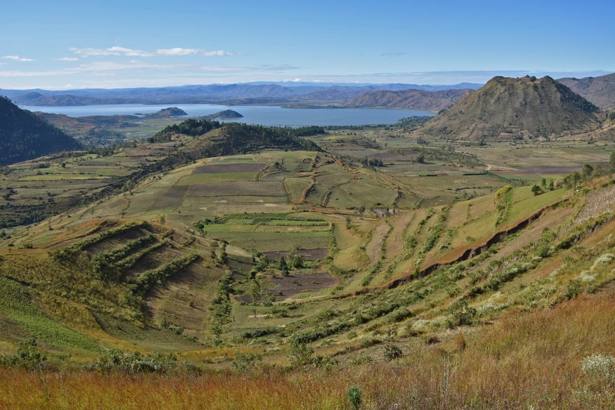
By the Faratsiho road, towards Antsirabe
This morning, we head due south on a beautiful, little-traveled mountain road that connects Itasy to Vakinankaratra. It passes through Soavinandriana and then crosses a succession of agricultural valleys nestled to the west of the volcanic massif of Ankaratra.
The landscapes are superb. All shades of green are displayed on the slopes of the hills, and the valley floors are occupied by rice paddies. On the slopes, farmers cultivate cassava, sweet potato and potato, and the red brick villages cluster around their church.
We stop at Faratsiho, a large town leaning against the foothills of Ankaratra, which overlooks a wide rice plain. It is market day for one or another of the villages we pass through, and the stalls are filled with vegetables, poultry and tools forged locally.
The road then descends towards Antsirabe. The landscape is covered with volcanic cones and crater lakes, signs of recent activity. The fertile soils make this region the granary of the Highlands: potatoes, carrots, beans and seasonal fruits are displayed along the roadside.
We reach Antsirabe in late afternoon. The thermal town, founded in the late 19th century around its hot springs, retains wide avenues lined with jacarandas. Pousse-pousse are countless. We visit artisans who make miniatures of bicycles and cars with recycled materials, and who work with zebu horn.
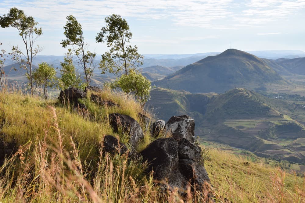
The marquetry craftspeople of Ambositra, then the Ranomafana forest
After breakfast, we resume National Road 7 towards the south. The road crosses the Highlands, between granite hills and rice valleys, and leads us to Ambositra, the capital of wood craftsmanship.
We meet marquetry artisans there. In their workshops, they assemble wood essences with natural colors to create scenes of daily life: peasants in the rice fields, zebu carts, pirogues. The sculptors work on statuettes and coffers. We take time to see the gestures and talk about the craft. The region is also the land of the Zafimaniry, whose art of wood sculpture is inscribed in UNESCO's intangible cultural heritage.
We then continue towards the east. After Alakamisy Ambohimaha, the road leaves the plateaus and plunges towards the eastern cliff. The landscape changes within a few kilometers: humid forest covers the slopes, waterfalls cascade down the hillsides, and the air becomes warmer and more humid.
We reach Ranomafana in the afternoon. The village has settled around hot springs, at the bottom of the Namorona valley, at the gates of the national park. This park protects more than 40,000 hectares of humid tropical forest and is part of the Atsinanana humid forests, inscribed in world heritage.
In late afternoon, we visit a Tanala village, about fifteen kilometers away. This forest people live from bamboo, wild honey and medicinal plants, in houses on stilts. We spend the night in Ranomafana.
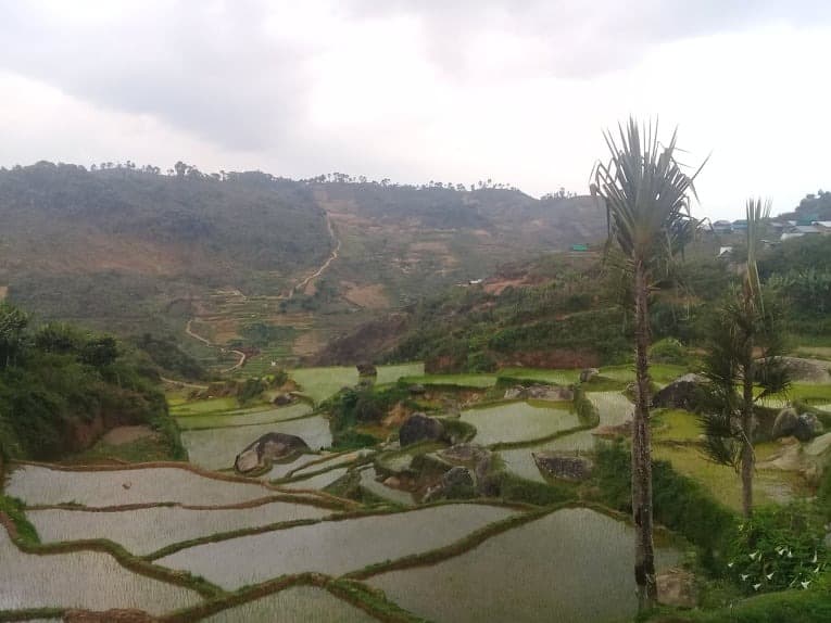
Ranomafana National Park, then Fianarantsoa
Early in the morning, when the forest is most alive, we enter Ranomafana National Park with a local guide. The trail follows the hillsides, crosses streams and disappears beneath a canopy of tall trees, tree ferns and bamboos.
The park is home to a dozen species of lemurs, including the golden bamboo lemur, discovered here in 1986 and which justified the creation of the park. With patience and discretion, we can observe lemurs as we walk, as well as chameleons, frogs, birds and orchids. Wildlife is free: no sighting is guaranteed, and this is what makes each encounter valuable.
Late in the morning, we resume our journey west and climb back up to the plateaus towards Fianarantsoa, the historic capital of the Betsileo country. The city is arranged in three districts: the upper town, with its churches and old houses, the administrative town and the lower commercial town.
In the afternoon, we meet the Relais Madagascar team. This social enterprise creates jobs in the sorting of secondhand clothing, textile manufacturing and waste recovery. It has also revived the manufacture of the Karenjy, the car designed in Fianarantsoa in the 1980s. The visit helps us understand how an economic activity can be built in service of local employment.
We spend the night in Fianarantsoa.
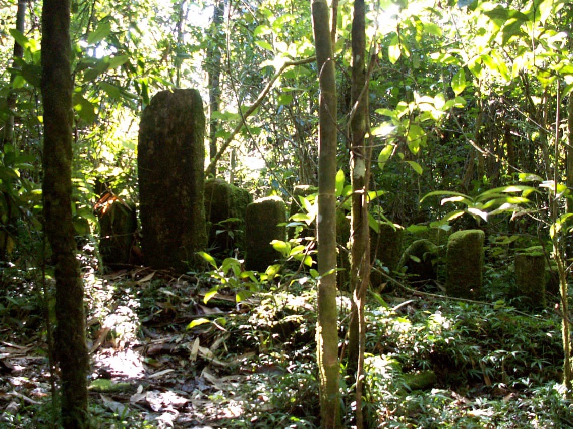
Anja and her lemurs, then the Tsaranoro
We leave Fianarantsoa heading south. The road crosses a patchwork of terraced rice fields and crops, then reaches Ambalavao, a small Betsileo town known for its handmade paper and its large zebu market.
A few kilometers further on, we stop at Anja village reserve. A forest of fig trees, lianas and orchids has developed between immense granite boulders. A colony of ring-tailed lemurs lives here in freedom. They spend a lot of time on the ground and are easy to observe. The reserve is managed by the village association, which reinvests its income in agricultural, social and educational projects.
After the visit, we leave the national road 7 for a track heading west through an increasingly mineral landscape. Granite domes multiply, villages become rarer, and a huge rock face soon rises before us: the Tsaranoro.
This massif is part of the Andringitra granite complex. Its eastern face, nearly 800 meters high, is one of the great climbing walls of the Indian Ocean. At its feet, a cultivated valley, a few Betsileo hamlets and groves of sacred forest make up a landscape of great beauty.
We settle for two nights in the heart of the valley, facing the cliffs that the setting sun colors red and gold.
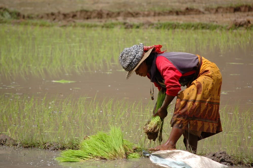
A day at the foot of the Tsaranoro walls
This day is devoted to the Tsaranoro valley, with a local guide. Two walks are offered, depending on the desire and fitness level of each person.
Good hikers climb to the summit of the rock known as the Chameleon. The path crosses fields and rice paddies, then rises over granite slabs, which offer good grip. From the summit, the panorama embraces the entire cirque: the great wall, the cultivated valley and, in the distance, the ridges of the Andringitra.
Those who prefer a gentler walk head to the foot of the wall, in the relict forest that has been preserved there. These groves, protected by ancestral prohibitions, the fady, shelter humid flora in the midst of a landscape that has become dry. Our guide explains these customs to us, and we follow his instructions.
The east face of the Tsaranoro stretches for nearly two kilometers and rises to 800 meters. Since the 1990s, climbers from all over the world have opened routes there among the most difficult in Africa, and the valley has become one of the world's great granite climbing sites. With a bit of luck, we spot ropes, tiny, on the wall.
These granites formed at depth, over 500 million years ago, then erosion exposed them. Lunch is taken as a picnic, and the end of the day is free, facing the cliffs.
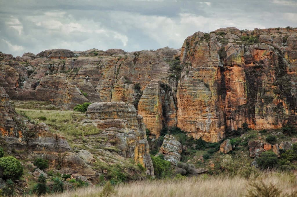
By the Horombe Plateau, towards Isalo
Vallée De Tsaranoro → Ranohira
We leave the Tsaranoro valley by track and rejoin national road 7 heading south. The last Betsileo villages fade away, and we enter Bara country, land of herders and large herds of zebu cattle.
The road then crosses the Horombe plateau, the largest in Madagascar. A vast expanse of grassy savanna unfolds before us as far as the eye can see, under a very wide sky. Villages are rare, as are trees. The Bara herd their zebu here, which represent far more than wealth for them: they mark a family's rank and accompany every stage of life.
Along the road, we make a few stops to photograph the plateau and stretch our legs. The landscape seems monotonous at first glance, but it changes with the light, and the shadows of clouds race across the golden grasses.
In early afternoon, a line of ruiniform reliefs appears on the horizon: the Isalo massif. The road runs along its sandstone cliffs, carved into towers, arches and canyons, before reaching the village of Ranohira, gateway to the national park.
We settle in for two nights. At the end of the day, slanting light sets the cliffs ablaze, and this is the best time for a short walk around the accommodation, amid the rock formations.
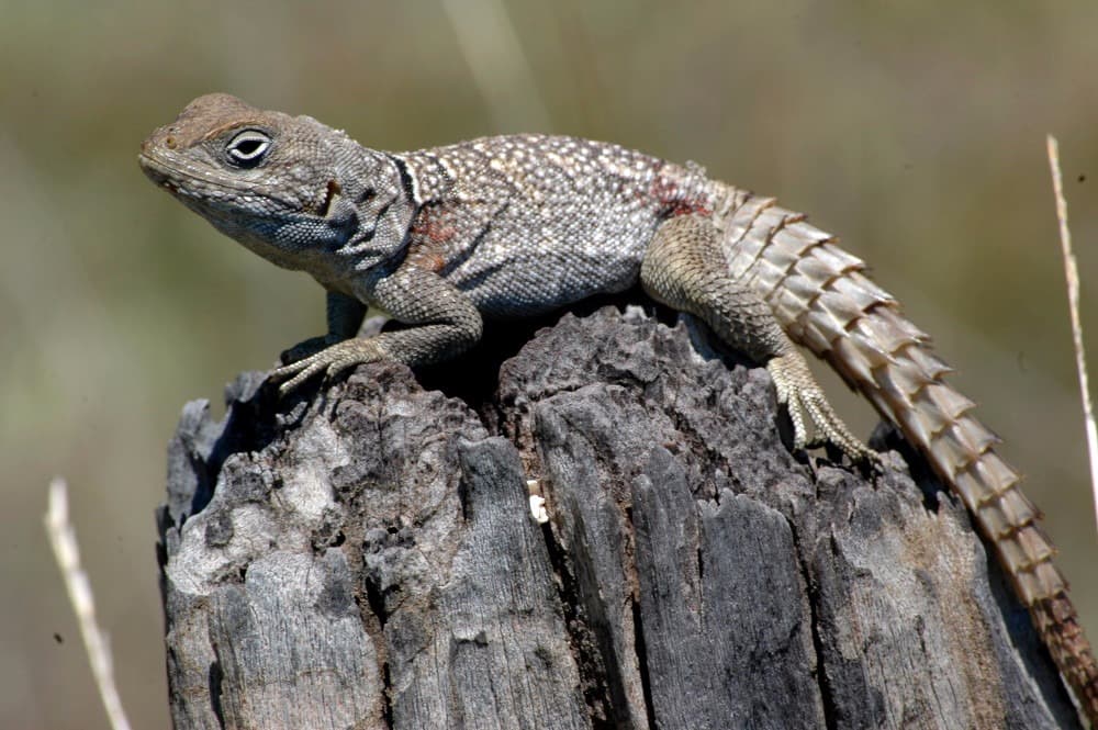
Les canyons et les piscines naturelles de l'Isalo
We devote the day to exploring Isalo National Park on foot, with a local guide. Created in 1962, the park protects a massif of continental sandstone, deposited by ancient rivers during the Triassic and Jurassic periods, then carved by erosion into deep canyons, towers and plateaus.
The trail first climbs onto the plateau. We walk between rocks of astonishing shapes, on a ground of sand and slabs, amid vegetation adapted to aridity: pachypodiums, also called elephant's feet, aloes and tough grasses. Views open onto the valley and neighboring cliffs.
We then descend into a canyon. Shade and water sustain very different vegetation here, greener, with palm trees and ferns. At the bottom, a waterfall fills a natural pool with clear waters, where we can swim. It's a refreshing stop before lunch.
In the afternoon, we continue hiking in another section of the park. With a bit of luck, we encounter lemurs, sifakas or ring-tailed lemurs, which live in the gallery forests of the canyons.
Isalo is also sacred land for the Bara people, who place their deceased in tombs carved into the cliff face. Our guide explains these customs to us, and we respect them. Return to Ranohira in late afternoon.
From Ranohira to Tuléar, through the Bara Country
We leave Ranohira towards the south-west. The road first runs along the last foothills of Isalo, then crosses the vast plains of the Bara country.
Shortly after departure, we cross Ilakaka. This small village of a few dozen inhabitants became, within a few months, a real mining town following the discovery of a major sapphire deposit in the late 1990s. Stone buying counters and wooden houses line the road. It is a face of today's Madagascar, that of the rush for precious stones.
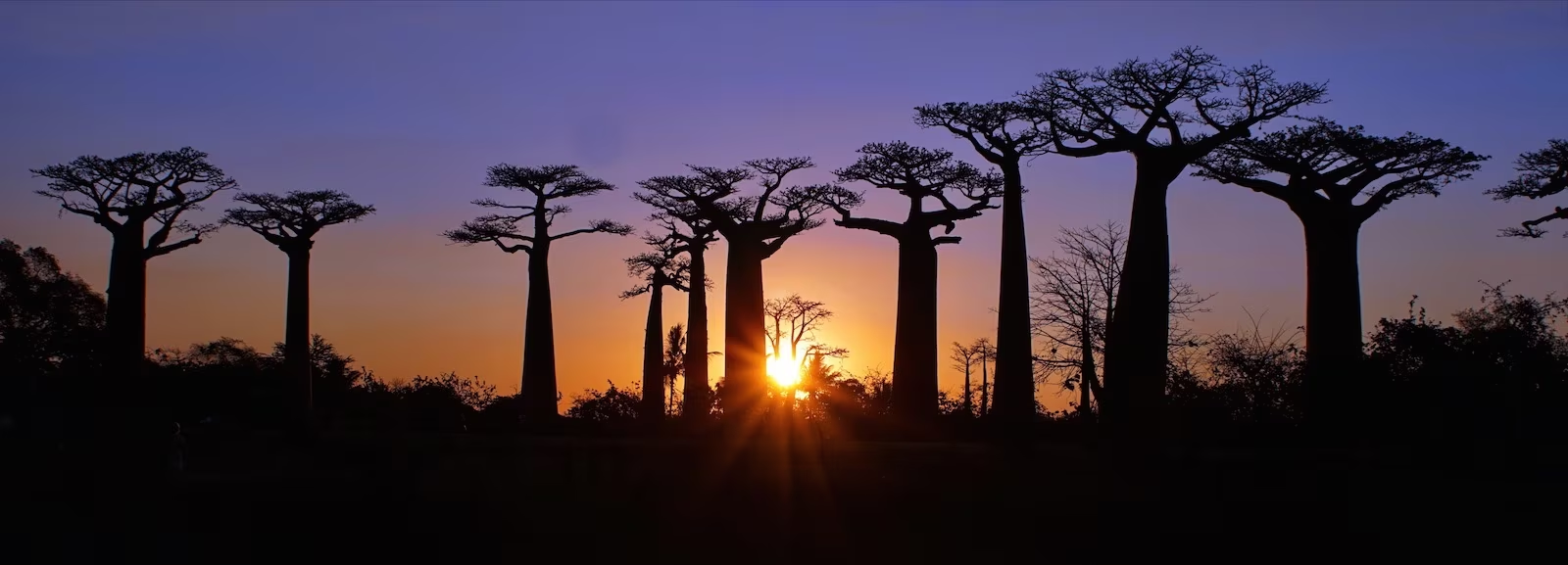
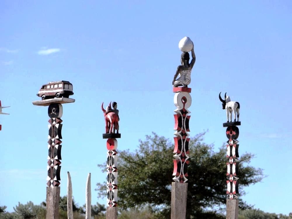
Further on, the landscape becomes drier. The first baobabs appear, isolated in the savanna, and the thorny vegetation announces the South-West. Along the road, we discover the first Mahafaly and Masikoro tombs, decorated with sculpted wooden posts, the aloalo, and sometimes with naïve paintings that tell the story of the deceased. We observe them from the road, with respect.
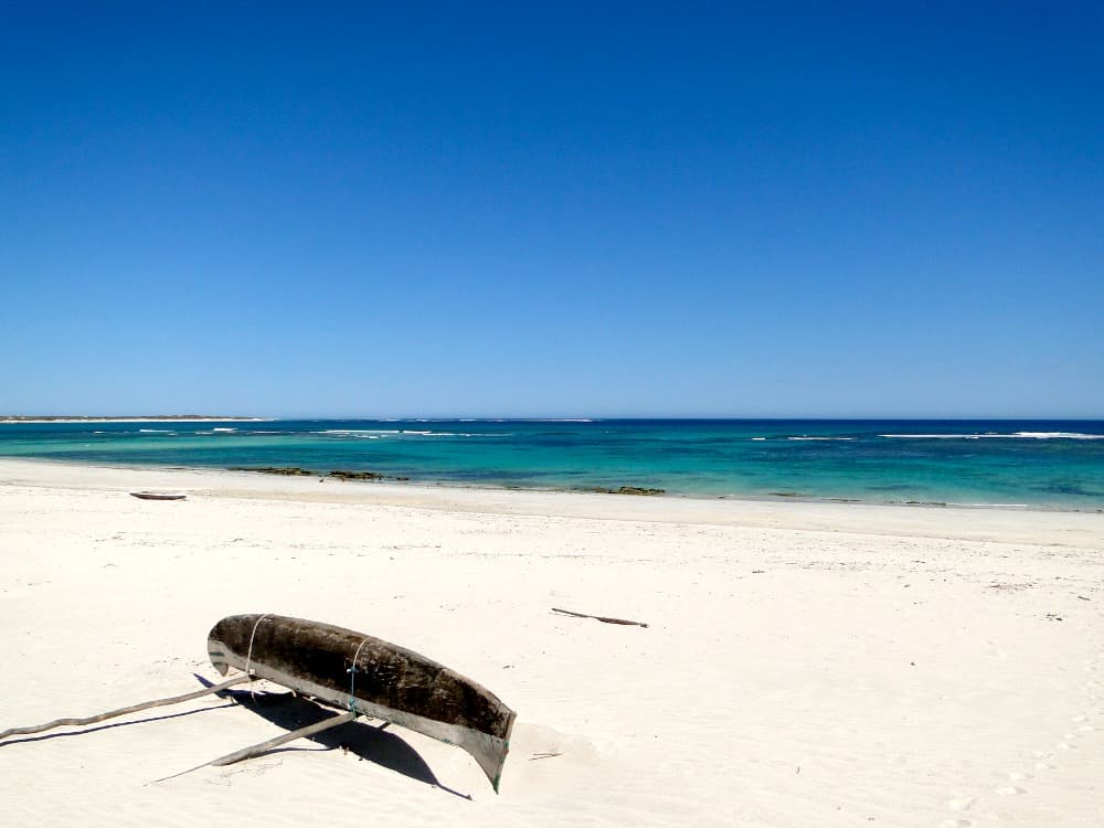
As we approach the coast, the air becomes charged with humidity and salt. We reach Tuléar in early afternoon. The city, capital of the South-West, stretches along the edge of a large lagoon protected by a coral reef.
The afternoon is free to stroll along the waterfront, in the town's lively market or to rest before taking to the sea tomorrow morning. We spend the night in Tuléar.
By sea, towards a lagoon of the Vezo country
Early in the morning, we head to the port of Tuléar and board a boat for a crossing to Anakao, south of Saint-Augustin Bay. Our driver-guide takes the track with the 4x4: he will meet us in two days, further south.
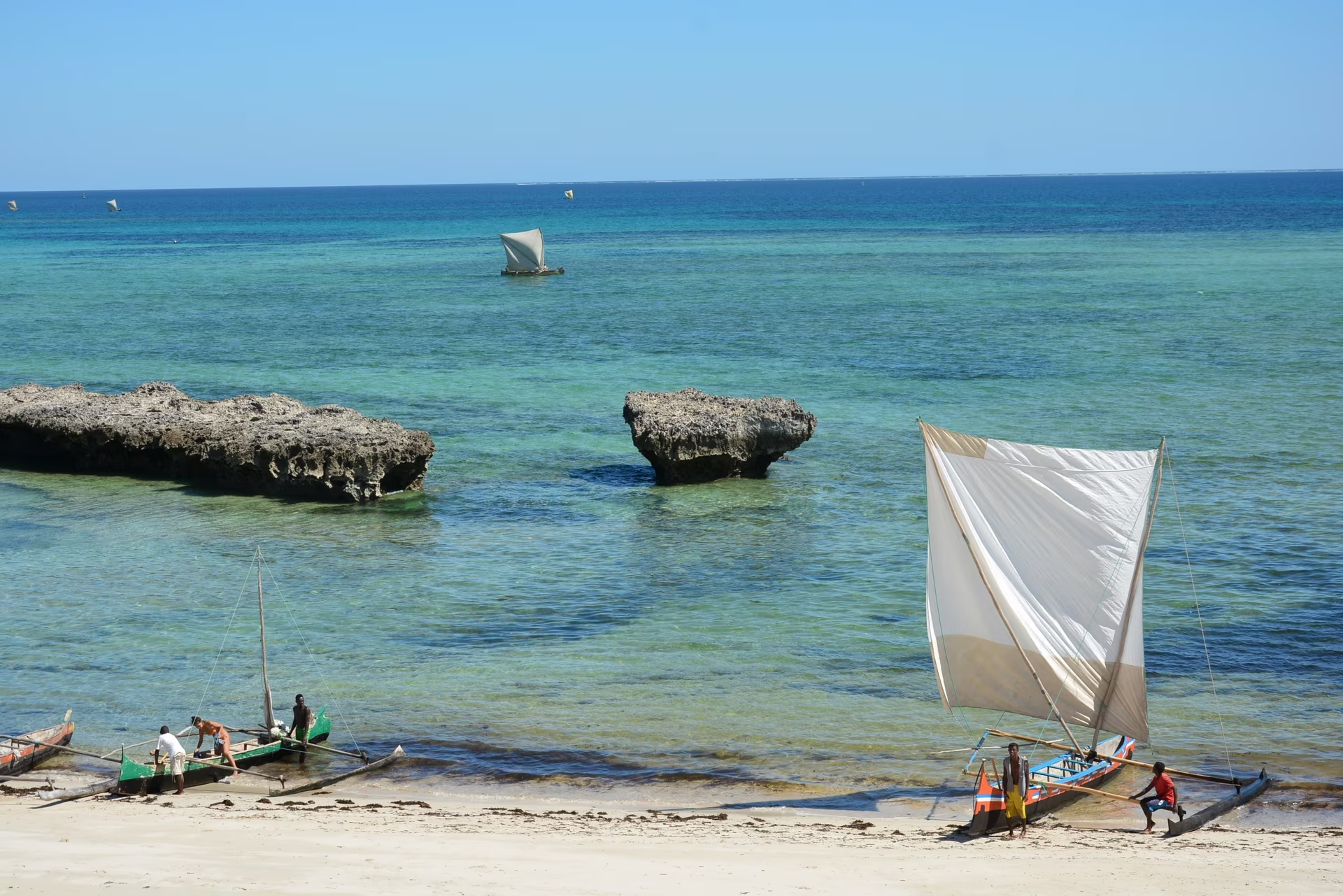
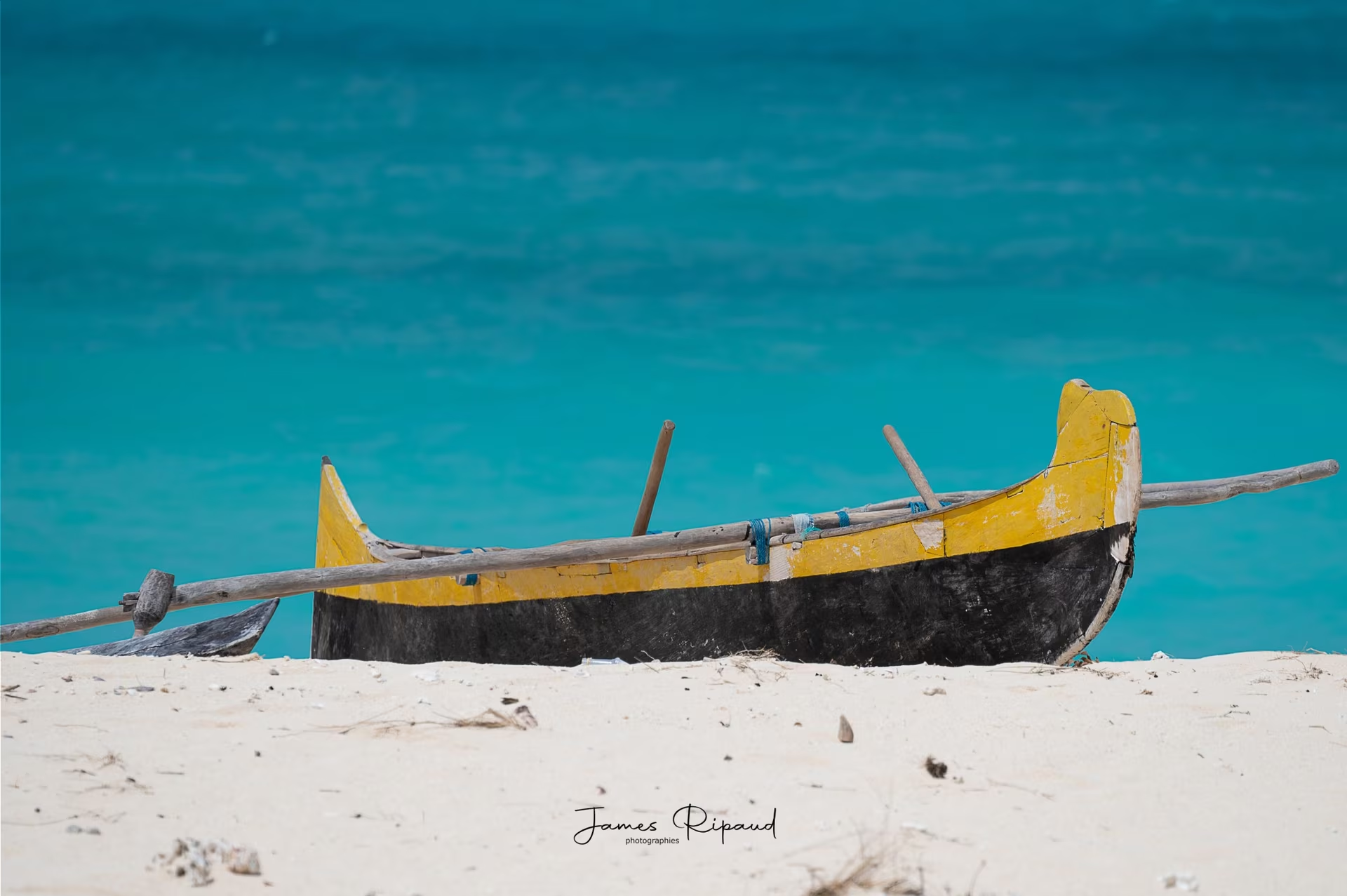
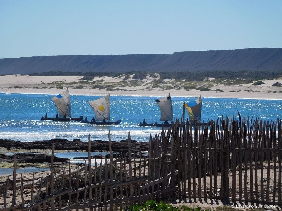
The crossing runs along the great reef that protects the lagoon. We disembark at Anakao, a Vezo fishing village situated on a white sand beach. The Vezo are a seafaring people. They live from fishing, aboard outrigger canoes carved from a single trunk and rigged with a square sail, and move along the coast according to the seasons and fish stocks.
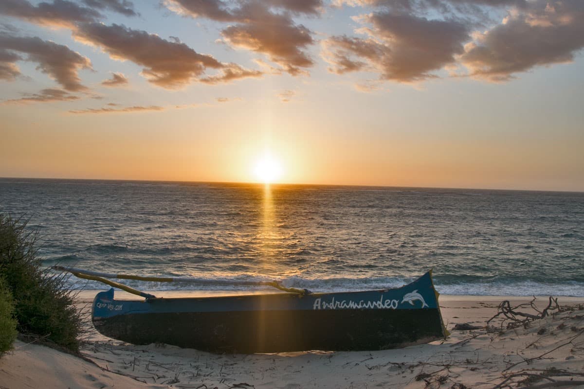
From Anakao, we take to the sea again aboard a motorized canoe, and sail along the coast toward the south. The landscape is made up of dunes, deserted beaches and mangroves. We arrive at the small village of Andramandeo, where our hosts welcome us for two nights.
It is a timeless place, and a wonderful adventure. It is simple: a few bungalows made of natural materials, sanitation facilities and a bucket shower, a large communal table, around which we share meals prepared with fish caught that morning in the lagoon. The simplicity is compensated by the beauty of the site, its calm and the welcome of the entire team.
In the afternoon, we explore the surroundings on foot, along the beach or in the dunes, before witnessing the return of the canoes at the end of the day.
Anakao → Andramandeo
Free day at Andramandeo Lagoon
This day is ours, at the lagoon's rhythm. After several days of travel and hiking, it's a time of rest, between the dunes, the beach and the ocean.
In the morning, low tide reveals the reef platforms and seagrass beds, and the village women go out to collect shells and octopuses. Offshore, outrigger canoes glide under their square sails towards the fishing grounds. The spectacle of this life turned towards the sea is a beautiful way to start the day.
On site, several activities are possible, to be organized with our hosts: an outing in a canoe in the lagoon or towards the mangrove, fishing with the villagers, snorkeling on the nearby reefs, or even surf or paddle lessons with the village youth. Those who prefer calm can simply swim, read or walk along the beaches, where we only meet a few fishermen.
At the end of the day, a walk on the dunes offers a wide view of the lagoon and reef, and the sunset over the Mozambique Channel.
In the evening, around the communal table, conversation continues with our hosts, who tell stories of village life, fishing seasons and the history of the coast. The Southern sky, without light pollution, is of remarkable purity.

Lake Tsimanampetsotsa and the Mahafaly Plateau
Andramandeo → Parc National de Tsimanampetsotsa
Early in the morning, we leave our hosts and board a pirogue to reach the neighboring village of Maromena. This is where we meet up with our driver-guide and his 4x4, to continue our journey towards the Far South.
The track runs along the coast, between dunes and thorny scrub, then leads us to Tsimanampetsotsa national park. The park extends at the foot of the Mahafaly limestone plateau, around a large shallow lake, laden with salt. Its white and turquoise waters welcome pink flamingos and other water birds depending on the season.
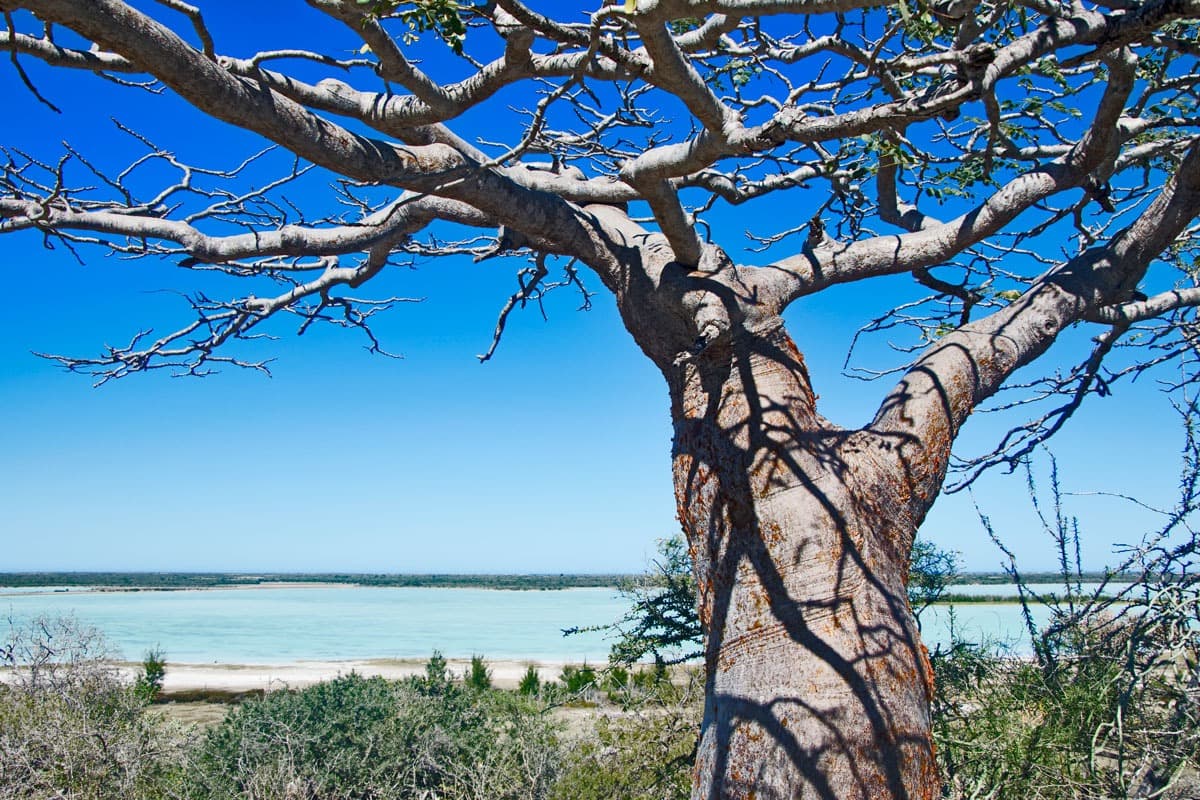
With a local guide, we set off on foot into the spiny forest. We discover baobabs there, including an enormous and very ancient specimen, pachypodiums and extraordinary flora, adapted to drought. The limestone is carved with caves and sinkholes, where fresh water springs feed small blind fish. With a bit of luck, we encounter radiated tortoises or lemurs.
Lunch is taken as a picnic in the park. In the afternoon, we reach the edges of the lake and discover Mahafaly funeral art: stone tombs, decorated with zebu horns and carved posts, tell the status and life of the deceased.
At the end of the day, we head to our accommodation, very close by, on the seafront, as the sky turns red in the setting sun.
Parc National de Tsimanampetsotsa → Domaine d'Ambola
The coastal trail to Itampolo
Domaine d'Ambola → Itampolo
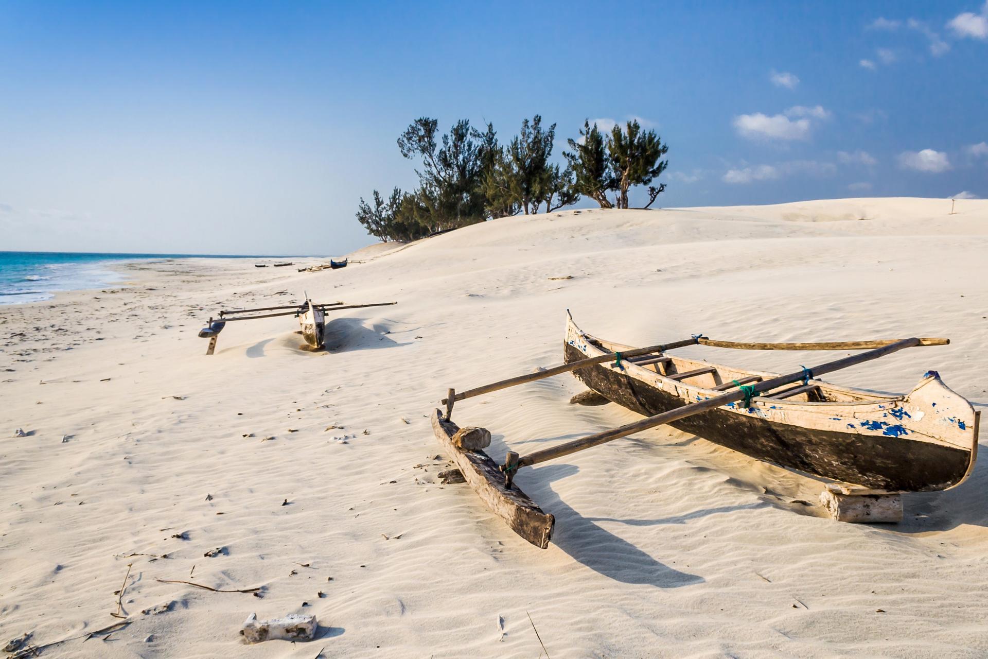
We continue south along the coastal track, one of the most beautiful and isolated in Madagascar. It winds between dunes, thorny scrub and the sea, with only a few vehicles passing by each day.
The landscape changes with each kilometer. In places, the track runs along the beach and offers wide views over the lagoon and coral reef, where ocean waves break. Elsewhere, it plunges into dry forest, amid euphorbias, didiereaceae and baobabs. Fishing villages succeed one another, made of wooden and leaf huts, facing the sea.
We stop to walk on the dunes, observe the pirogues or chat with locals, as the road takes us. Our driver-guide knows this coast and its customs well, and explains to us how villages live from fishing, goat herding and small-scale farming, in an environment where fresh water is rare and precious.
Lunch is taken as a picnic, in the shade of a tree or by the beach.
We reach Itampolo in early afternoon. The village stretches along one of the most beautiful beaches on the southwest coast, kilometers of white, fine sand. The rest of the day is free: swimming, a walk on the beach or rest. We spend the night in simple accommodation, by the sea.
Picnic lunch
The crossing of the Mahafaly plateau to Lavanono
This is the longest and wildest stage of the journey. We leave the coast to cross the Mahafaly plateau via a sandy track, often carved into limestone rock, which requires all the experience of our driver-guide.
The plateau is the domain of the spiny forest, one of Madagascar's most unique habitats. The didiereacae plants raise their stems covered in spines, euphorbs form candelabras and baobabs punctuate the horizon. Almost all of these plants are endemic. They store water in their trunks or roots and reduce their leaves to resist drought.
This region is also home to many radiated tortoises, living in the wild. For local populations, they are protected by an ancestral taboo, a fady, which forbids touching or eating them. We observe them without touching them.
Lunch is taken as a picnic, along the way. In the afternoon, the track reaches the coast. Around a bend, a long line of limestone cliffs rises above the ocean: we arrive at Lavanono, a small fishing village nestled at the foot of these cliffs, facing a wide beach battered by waves.
We settle in for two nights in simple accommodation, with bucket shower and outdoor toilets, in an exceptional setting. The beauty of the place and the tranquility more than compensate for the basic comfort.
Picnic lunch
Cape Sainte-Marie, at the tip of Madagascar
This morning, we head towards Cape Sainte-Marie, the southernmost point of Madagascar. A short track leads us to the entrance of the special reserve, which protects the limestone plateau and its vegetation.
With a local guide, we walk on the plateau swept by the wind. The vegetation there is remarkable: shrubs, euphorbias and succulents remain dwarf, flattened to the ground. This is not an anomaly, but an adaptation to drought and wind strength. The reserve is also home to one of the island's most important populations of radiated tortoises, and these tortoises are often easy to observe at the edge of the trails.
On the dunes, fragments of aepyornis eggshells, the extinct elephant bird, sometimes surface in the sand. They are part of the site's heritage: we look at them without collecting anything.
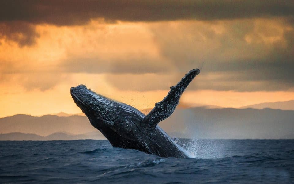
We finally reach the lighthouse and the cliff that overlooks the ocean. Here, the land ends. Further south, there is only sea until Antarctica. Humpback whales cruise offshore in season, between July and October.
After a picnic on the plateau, we return to Lavanono. The end of the day is free, for a walk at the foot of the cliffs, a swim if the sea permits, or a moment of peace facing the ocean. We spend a second night in Lavanono.
Picnic lunch
Through the Antandroy country, to Fort-Dauphin
After an early breakfast, we take the track heading east, across the Antandroy country. The Antandroy, "those from the land of thorns", live from herding and dry farming in one of the most arid regions of the island. Their tombs, vast stone enclosures decorated with zebu horns and carved posts, stand along the roadsides.
It is hot, sometimes very hot, and the track is chaotic. Everything must be earned in the Far South. We cross Ambovombe, then Amboasary, on the edge of the Mandrare river, where vast sisal plantations stretch out, a plant whose fibers were used to make ropes and sacks.
After Amboasary, the landscape changes dramatically. Within tens of kilometers, the thorn forest gives way to a transition forest, then to humid forest. The Anosyan range, which blocks the horizon, stops the clouds coming from the Indian Ocean: on one side, drought, on the other, rain and lush vegetation.
We arrive in Fort-Dauphin in late afternoon. The city extends over a peninsula, between bays bordered by beaches and mountains covered in forest. It was the first French settlement in Madagascar, in the 17th century.
It is here that we part ways with our driver-guide, who heads back to the capital. In Fort-Dauphin, transfers are handled by our local team.
Through the channels to Lokaro Bay
This morning, we head to the landing stage and set off by motorized canoe towards the north. The canoe travels through a series of narrow channels linking several coastal lakes, between the sea and the mountains.
The navigation is peaceful. The banks are covered with coastal forest, pandanus and ferns, and the Anosyan mountain range draws its peaks in the background. Fishermen set their traps in the calm waters, and birds—herons, egrets and kingfishers—fly away at our passage.
We land at the village of Evatraha, at the end of a peninsula. Those who wish can easily climb the mountain overlooking the village, for an overview of the lakes, the peninsula and the sea.
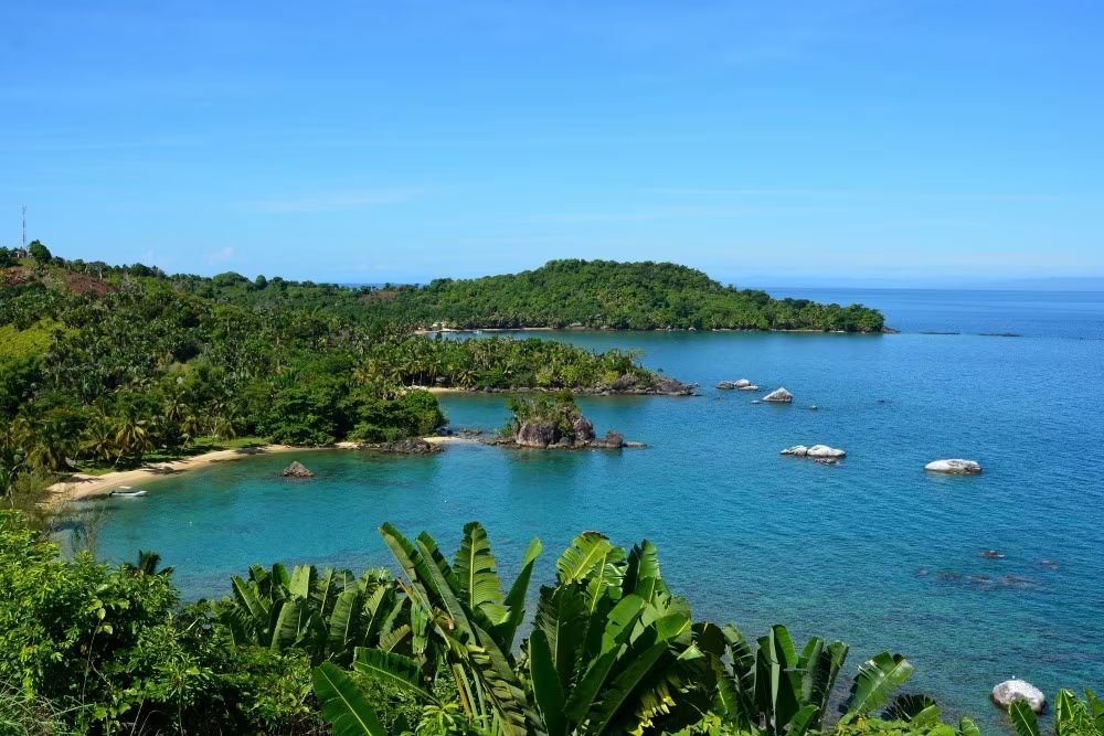
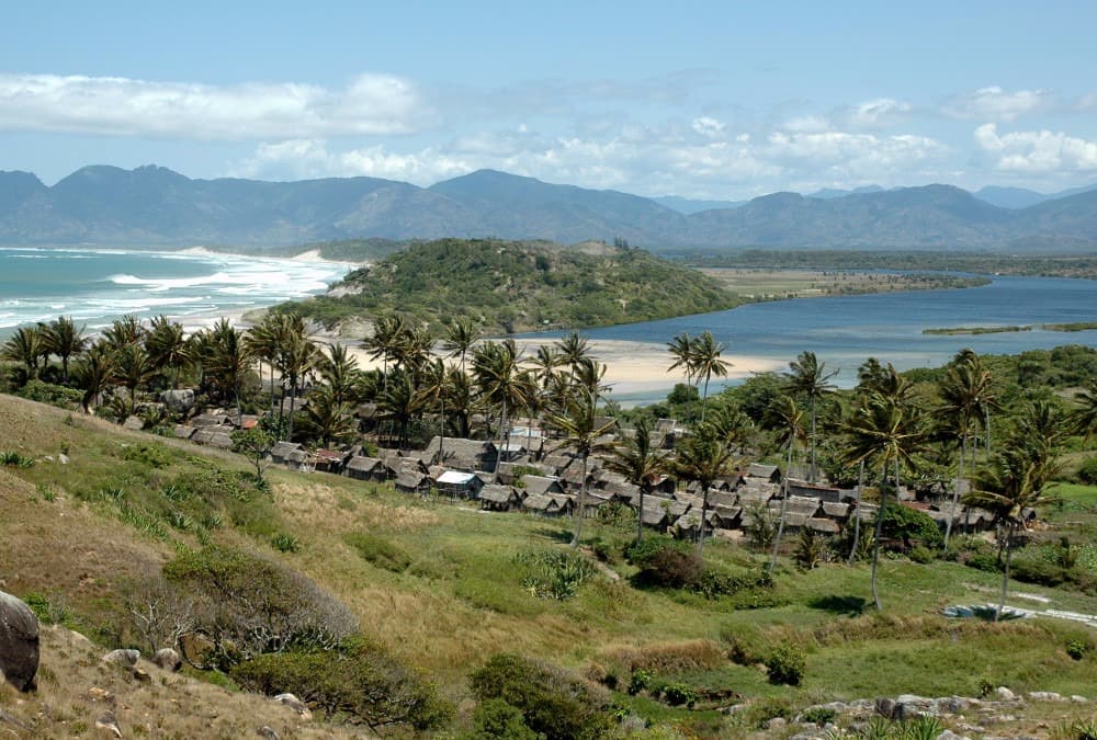
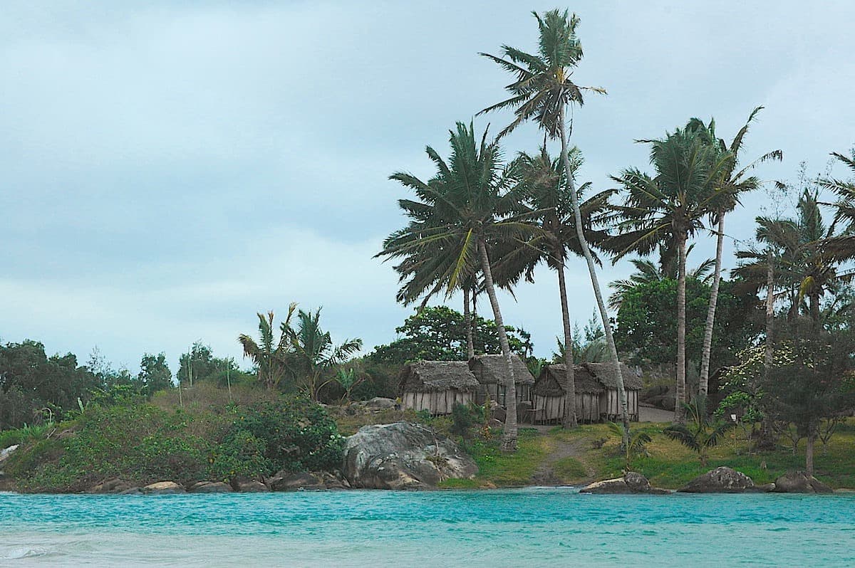
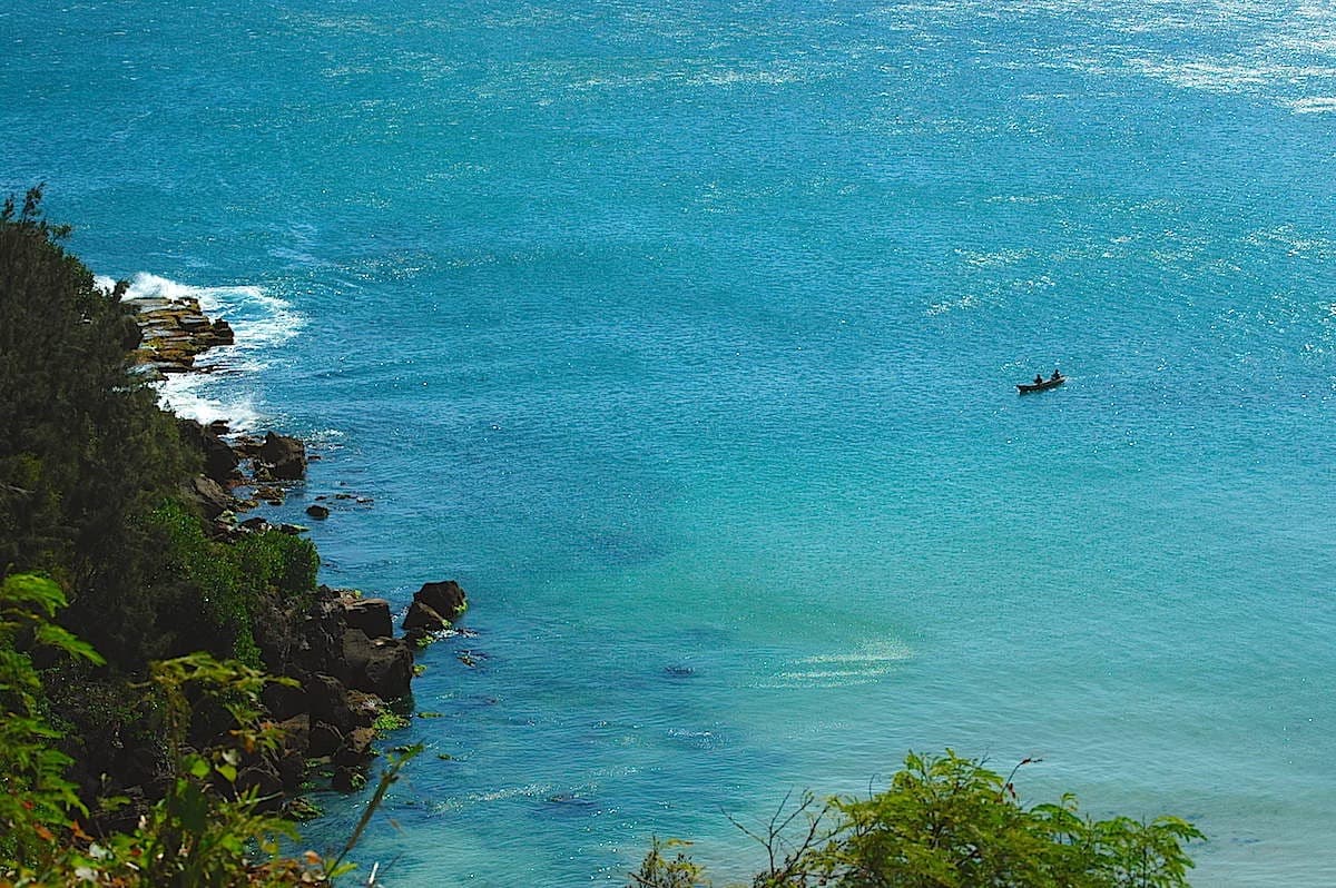
From Evatraha, we set off on foot towards Lokaro Bay. The trail first climbs and offers a magnificent view over the bay, its turquoise waters, its islets and its golden sand beaches. It then descends and runs along the beach to our accommodation, in the heart of the bay, which we reach in early afternoon.
The rest of the day is free. The bay is protected by a barrier of rocks, and its calm waters invite swimming. We spend two nights at Lokaro, on the shores of the Indian Ocean.
Lokaro Bay
This day is free, on the edge of one of the most beautiful bays on the south-east coast. After the long crossing of the South, it is a moment of rest, between the beach, the forest and the sea.
Lokaro Bay opens onto the Indian Ocean, but it is protected from the swell by rocks and islets. Its waters are clear and calm, and its golden sand beaches, lined with filao trees, are almost deserted. Snorkeling is possible around the rocks, where many reef fish live.
For walkers, a panoramic trail of about two hours runs along the coast and climbs onto the promontories. It offers superb views over the bay, the islets and the Evatraha peninsula. Along the way, the coastal forest is home to pitcher plants, these carnivorous plants whose leaves form urns, and very rich flora.
It is also possible to organize, on site, a boat trip to the islets or a meeting with fishermen from the nearby village. Those who prefer peace and quiet can simply enjoy the beach and the sound of the waves.
At the end of the day, golden light glides over the bay and over the mountains of the Anosyan mountain range. It is our last evening by the ocean, far from the roads.
Return to Fort-Dauphin
We leave Lokaro Bay on foot, via the same trail as on arrival, for an hour's walk to the village of Evatraha. The morning light gives the bay different colors, and the views from the trail are just as beautiful as on arrival.
In Evatraha, we board the motorized pirogue and travel through the channels, between sea and mountain, until Fort-Dauphin. We arrive late morning, and our local team takes us to our hotel.
The afternoon is free to discover this end-of-the-world town at your leisure. The remains of Fort Flacourt recall that Fort-Dauphin was, in the 17th century, France's first trading post in Madagascar. On Libanona beach, late in the afternoon, fishermen return with their pirogues. The flats of False Bay of the Galleons, where lobster fishermen set their traps, also offer a lovely walk.
The town market, lively and colorful, showcases the region's products: tropical fruits, fish, spices and woven goods. Our team can also organize, on request, an excursion to the rainforests of the interior.
Dinner is free. This is an opportunity to taste the lobsters and seafood from the coast, which have a reputation throughout the island. We spend the night in Fort-Dauphin.
Flight to Antananarivo
According to the domestic flight schedule, we take advantage of the morning for a last stroll in Fort-Dauphin or along its beaches. Our local team then drives us to the airport.
The flight goes up the island from south to north. In good weather, it offers a final overview of the landscapes we've crossed: the Anosian mountain range and its forests, then the reliefs of the Highlands and the rice paddies of the valleys. In just over an hour, we cover the distance that took us three weeks to travel by road, track and sea.
Upon our arrival in Antananarivo, a member of the Détours Madagascar team welcomes us and takes us to our hotel, in the center of the capital.
In the evening, we enjoy the cool air of the Highlands, after the heat of the South. It's time to review the trip with our team, share our impressions and prepare for our return. We can also give them our feedback: it helps us improve our trips, and we respond to it. The last photos are exchanged, travel journals are completed.
Dinner is at leisure. We can choose one of the capital's fine dining restaurants for a last meal with Malagasy flavors. We spend the night in Antananarivo.
Last day in Antananarivo
This last day is free, until the transfer to the airport for the international flight, which usually departs in the evening or at night.
For those who feel like walking, Antananarivo is best discovered on foot, from hill to hill. From the upper town, stairs and narrow streets descend towards the commercial districts, and viewpoints offer wide views over the plain and its rice fields. Our team can also organize an outing to the royal hill of Ambohimanga, about twenty kilometers to the north, listed as a UNESCO World Heritage site (vehicle and guide at additional cost).
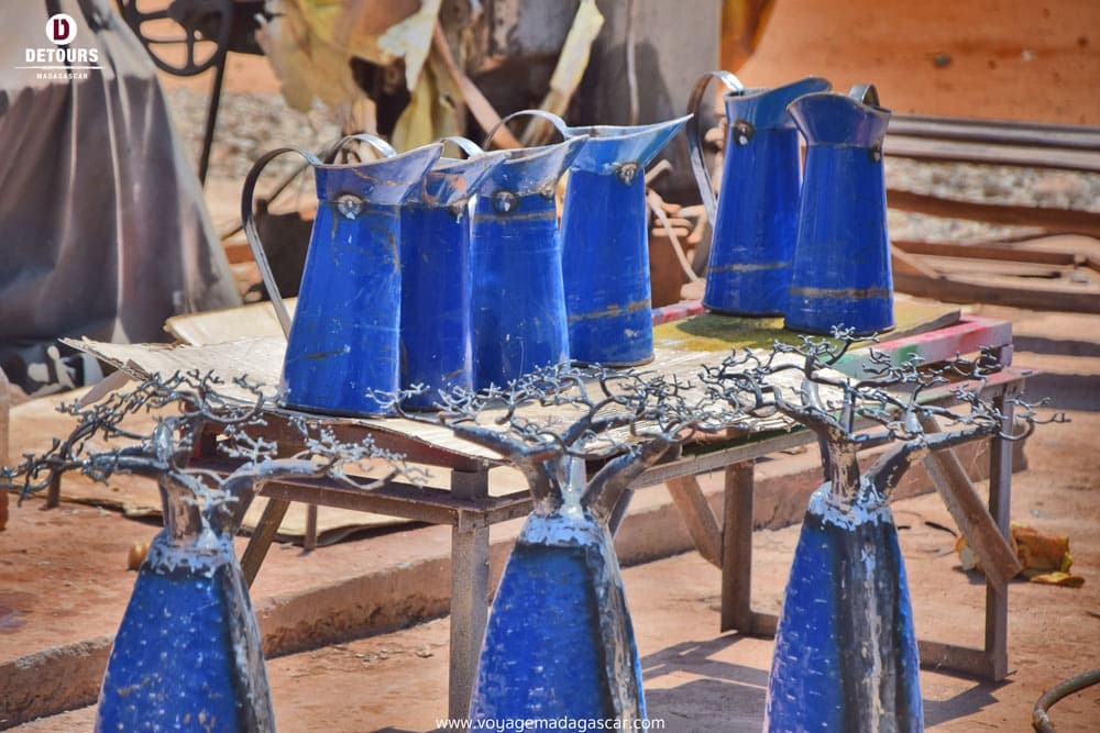
The capital also brings together many artists and craftspeople from the country. Blacksmiths, leather workers who work with zebu leather, embroiderers and basket weavers have their workshops and galleries in the city, and it's an opportunity to bring back a souvenir made locally.
Rooms must be vacated by late morning, but it is possible to keep them until departure, with a supplement, depending on availability.
In the late afternoon, a member of the Détours Madagascar team takes us to Ivato international airport for our return flight. This marks the end of a long journey through the South, from the volcanoes of Itasy to the beaches of Lokaro.
Antananarivo → Paris Roissy CDG
Price per person
Indicative price per person, based on double room. Each trip is customized according to your preferences.
This trip can be tailored to your preferences
This itinerary provides an excellent foundation for discovery, but it can be fully customized. Our local advisors build each trip tailored to your budget, dates and preferences.
Not included
- International flights
- The domestic flight from Fort-Dauphin to Antananarivo (fluctuating rate, booked separately)
- Visa fees
- Meals not mentioned in the program and beverages
- Optional activities (snorkeling, outrigger canoe excursions, massages)
- Single room supplement: €580 per person
- Insurance assistance, repatriation and cancellation
- Tips
- Personal expenses
Included
- Airport welcome and transfers in Antananarivo
- 4x4 with driver-guide, expedition leader, from day 2 to day 17, fuel included
- Boat and motorized pirogue crossings (Tuléar, Anakao, Andramandeo, Maromena, Evatraha)
- Local transfers in Fort-Dauphin
- Double or twin room accommodation for 21 nights
- Breakfasts, full board at Andramandeo (D11 and D12), dinners at Tsaranoro (D6 and D7), at Lavanono (D15 and D16) and at Lokaro (D18 and D19)
- Picnic lunches on trail and hiking days
- Entrance fees and local guides for parks and reserves (Ranomafana, Anja, Tsaranoro, Isalo, Tsimanampetsotsa, cap Sainte-Marie)
- The assistance of our team in Antananarivo throughout the journey
Practical Information
Registration is considered firm and final after payment of a deposit of 40% of the total price and acceptance of the specific terms of sale.
The balance must be paid no later than 45 days before the departure date.
See our specific terms of sale for full details.
In the event of cancellation by the traveller, the following fees apply:
More than 60 days before departure: 40% of the total price (deposit retained)
Between 60 and 30 days before departure: 50% of the total price
Less than 30 days before departure: 100% of the total price
We strongly recommend taking out cancellation insurance. See our specific terms of sale for full details.
Your Passport:
Important: your passport must be valid. It must be absolutely and obligatorily valid for 6 months after the end of your stay in Madagascar.
Your travel documents
Your valid passport,
Your international and/or domestic flight tickets,
Your repatriation and emergency care insurance contract,
Your vaccination record if applicable,
Your blood type card if possible.
Obtaining a visa to enter Madagascar
Upon arrival in the territory:
Since February 16, 2026, the visa costs €30 for up to 15 days, €35 for 16 to 30 days, €40 for 31 to 60 days and €50 for 61 to 90 days. It can also be requested online before departure on the official e-visa portal (evisamada.gov.mg). An additional tourist tax of €10 is paid in cash upon arrival.
It is easily obtained upon your arrival in Madagascar.
This applies to all airports in Madagascar that handle international flights.
Upon arrival at the airport terminal, upon exiting the plane, a corridor for passengers is dedicated to issuing tourist visas.
This procedure is the simplest. We recommend it to you.
At the embassies and consulates of your home countries:
For information, download the document explaining the procedure and the file requirements for obtaining a visa from the Embassy of Madagascar.
To participate in our trips, it is strongly recommended to be insured for repatriation assistance and medical expenses abroad.
Your local agency encourages you to familiarize yourself with the specific contract developed with our partner CHAPKA ASSURANCES and AXA ASSISTANCE.
To subscribe to insurance, learn about coverage and rates, follow the link below.
CAP EXPLORER: The comprehensive insurance solution designed to enjoy your trip with peace of mind!
Choose the plan that best suits you:
Explorer'Multirisque
Explorer'Annulation
Explorer'Assistance
Specific to our trips, we strongly recommend subscribing to them.
If you choose to subscribe to one of these plans, the policy detailing all coverage and procedures for claiming any loss are available on the insurer's website.
Your local agency will be aware of it, but only the participant is responsible for complying with the procedures for declaring any loss. The participant must therefore keep this policy with them throughout their trip.
Chapka — Cap Explorer
Our insurance partnerTravel with peace of mind with our partner Chapka. Cancellation, repatriation, medical expenses, baggage… All the coverage for a worry-free trip.
Travel with peace of mind — I'll handle the insuranceFrequently asked questions
A tourist visa is required, issued upon arrival at Ivato Airport (Antananarivo) or online (e-visa). Your passport must be valid for at least 6 months from your date of entry. Before booking your trip, check with Madagascar's consular authorities for the conditions applicable to your nationality, including visa fees and authorized lengths of stay.
Go to the My Trips section to find all your projects.
You can send a message to your host directly from the Tea Lounge.
For a tailor-made quality trip, expect between 160 and 270 euros per day and per person, including accommodation, meals, internal transfers and English-speaking guide. International flights (900-1400 euros return) are additional. Long transfers and domestic flights represent a significant portion of the budget.
Your documents are accessible in the Documents tab of your trip.
Absolutely. We adapt each itinerary to suit your travel profile. For families, we prioritize relaxed pacing, family-friendly accommodations, fun and educational activities, and comfortable private transfers. Our local English-speaking guides know how to captivate children with age-appropriate anecdotes.
It's simple. You exchange with our local team to define your wishes, budget and dates. You receive a detailed itinerary proposal within 48 hours. You adjust every detail together until it's perfect. You confirm and travel with peace of mind. Your local agency remains available 7 days a week throughout your trip.
In case of emergency, contact your local agency immediately.
Payment is generally made in two installments.
Our agency is part of the Nomadays network, registered in France. You benefit from APST (Association Professionnelle de Solidarité du Tourisme) protection, which covers 100% of your funds. Secure payment, professional insurance, and English-speaking assistance 7 days a week on the ground throughout your stay. Travel insurance (assistance and repatriation, cancellation) is not included: we offer it through our insurance partner and strongly recommend it.

Let's talk about your adventure — High Plateaus
Ambassador of Malagasy fihavanana, based in Antananarivo
For me, traveling to Madagascar is stepping into the spirit of fihavanana: sharing, helping one another, meeting people, and taking time to understand what connects them to their land.
— Noro